Drone Survey: Complete Guide to Modern Land Mapping, Inspection and Accurate Data Collection
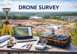
Drone survey has transformed the way land measurement, mapping, inspection, and site analysis are performed across industries. By using advanced unmanned aerial vehicles (UAVs) equipped with high-resolution cameras, GPS systems, and mapping software, drone surveys provide fast, accurate, and cost-effective solutions for construction, agriculture, mining, real estate, infrastructure, and industrial projects.
Traditional surveying methods often require more time, manpower, and physical site access, especially in difficult terrain or large-scale projects. Drone surveys improve efficiency by capturing precise aerial data in a shorter time while reducing safety risks and operational delays.
In India, the use of drones is regulated by the Directorate General of Civil Aviation under drone operation rules and digital airspace compliance systems to ensure safe and lawful usage.
What is a Drone Survey
A drone survey is the process of collecting aerial data using drones for mapping, inspection, measurement, and analysis of land or structures.
The drone flies over a designated area and captures high-resolution images, videos, and geospatial data.
This information is processed using specialized software to create maps, 3D models, contour plans, orthomosaic images, and elevation reports.
Drone surveys are used for land boundaries, construction monitoring, roof inspections, crop analysis, mining assessments, and infrastructure planning.
The method improves both speed and accuracy.
It supports better planning and decision-making.
Importance of Drone Survey
Accurate surveying is essential for property development, construction safety, project planning, and legal compliance.
Traditional surveys can be slow and expensive, especially in remote or hazardous areas.
Drone surveys reduce manual effort and provide detailed visual data quickly.
They help businesses avoid planning errors, legal disputes, and unexpected project costs.
Real-time aerial insights improve decision-making and reduce operational risk.
Precision improves investment security and project efficiency.
Modern industries depend heavily on accurate data.
Land Survey and Mapping
One of the most common uses of drone surveys is land mapping.
Surveyors use drones to measure boundaries, prepare topographical maps, identify elevation levels, and support land registration processes.
This is highly useful for real estate projects, infrastructure development, road planning, and government land records.
Drone-generated orthomosaic maps provide highly accurate visual references for legal and technical purposes.
Fast land analysis improves project approvals and investment decisions.
Precision reduces future boundary disputes.
Reliable mapping supports strong property planning.
Construction Site Monitoring
Construction companies use drone surveys for project monitoring, progress tracking, and site planning.
Aerial images help compare actual work with project plans and identify delays, material movement, and safety concerns.
Engineers and project managers use drone data for better supervision and reporting.
This reduces the need for repeated manual inspections and improves communication between teams.
Construction efficiency improves when decisions are based on real-time visual evidence.
Time-saving is one of the biggest advantages.
Monitoring becomes smarter and more transparent.
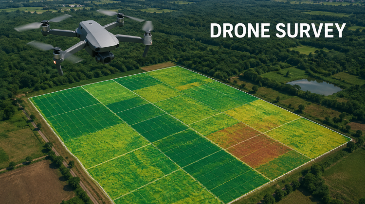
Agriculture and Farm Survey
Agriculture is one of the fastest-growing sectors for drone survey usage.
Farmers and agricultural companies use drones for crop monitoring, irrigation planning, soil analysis, pest detection, and fertilizer management.
Aerial imaging helps identify unhealthy crop zones early and improves productivity.
Large farms benefit from faster monitoring compared to traditional field inspection.
Precision farming supports better yield and lower resource wastage.
Technology-driven agriculture improves sustainability and profitability.
Smart farming depends on accurate data.
Mining and Industrial Inspection
Mining companies use drone surveys for stockpile measurement, excavation planning, environmental monitoring, and safety inspections.
Industrial plants use drones for chimney inspection, roof checks, tank monitoring, and hazardous area analysis.
Drones improve worker safety by reducing the need for risky manual access.
Accurate volume calculations support financial planning and compliance reporting.
Inspection speed improves significantly in large industrial environments.
Risk reduction is a major business advantage.
Safety and efficiency work together.
Road, Bridge and Infrastructure Projects
Infrastructure projects such as highways, bridges, railways, pipelines, and power lines require detailed site inspection and progress monitoring.
Drone surveys help engineers inspect structures, identify defects, and plan maintenance more effectively.
Large infrastructure areas can be monitored quickly without disrupting operations.
Government projects benefit from transparency and visual reporting.
Maintenance planning becomes more accurate and cost-efficient.
Preventive inspection reduces future repair costs.
Infrastructure safety depends on regular monitoring.
Real Estate and Property Development
Real estate developers use drone surveys for land analysis, marketing visuals, and project planning.
Buyers and investors benefit from clear aerial views of property location, surroundings, road access, and development potential.
Developers use drone mapping for project design and legal documentation.
Drone visuals also improve property marketing and investor presentations.
Clear site visibility improves buyer confidence.
Better presentation supports stronger investment decisions.
Visual trust matters in property transactions.
Legal Compliance and Drone Permissions
Drone operations in India must comply with rules set by the Directorate General of Civil Aviation.
Depending on drone category and usage, registration, pilot certification, airspace permissions, and operational approvals may be required.
Unauthorized drone usage can result in penalties and legal consequences.
Commercial survey providers must ensure compliance with safety and privacy standards.
Professional operators understand both technical and legal responsibilities.
Compliance protects both service providers and clients.
Safe operations are non-negotiable.
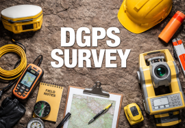
Technology Behind Drone Survey
Drone surveys depend on advanced GPS systems, LiDAR, photogrammetry, RTK technology, and mapping software.
These tools improve accuracy and support complex reporting.
3D modeling and cloud-based project sharing make collaboration easier between engineers, architects, surveyors, and investors.
Automation improves speed and reduces manual calculation errors.
Technology continues to make surveys more precise and accessible.
Digital transformation is reshaping the surveying industry.
Accuracy is now smarter and faster.
Conclusion
Drone survey is one of the most powerful modern solutions for mapping, inspection, and data-driven project planning. From land measurement and agriculture to construction monitoring and industrial inspection, drone technology improves speed, safety, and accuracy across industries.
Regulated by the Directorate General of Civil Aviation, professional drone surveying supports legal compliance, smarter investment decisions, and long-term operational efficiency.
In today’s competitive environment, accurate information creates stronger results—and drone surveys provide that advantage from above.