At Geotrak, we provide specialized Hydrographic Studies to support maritime, infrastructure, and environmental projects. Our services ensure precise mapping and analysis of underwater terrains, aiding in efficient planning and development.
Key Services
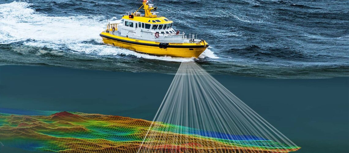
Bathymetric Surveys: Measure underwater depth and topography for accurate seabed mapping.
Coastal Zone Mapping: Analyze shoreline changes and coastal features for sustainable development.
Hydrodynamic Studies: Assess water flow, currents, and wave dynamics for engineering projects.
Sediment Transport Analysis: Evaluate sediment movement to support dredging and erosion management.
Tidal and Water Level Monitoring: Monitor tidal patterns and water levels for navigation and infrastructure planning.
Seabed Composition Analysis: Identify sediment types and seabed materials for construction and environmental assessments.