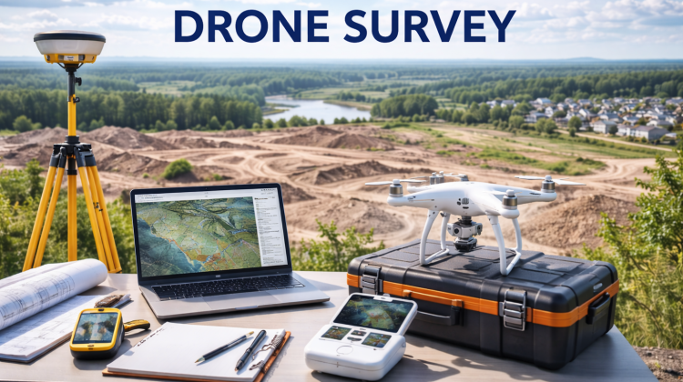
Drone Survey: Meaning, Technology, Applications, and Benefits in India
Drone surveying is a modern technique that uses unmanned aerial vehicles (UAVs), commonly known as drones, to capture aerial data for mapping, inspection, and analysis. It has revolutionized traditional land surveying methods by providing faster, more accurate, and cost-effective solutions across various industries such as construction, agriculture, mining, and infrastructure development.
With advancements in technology and supportive government policies in India, drone surveys are becoming an essential tool for businesses and government projects.
What is a Drone Survey?
A drone survey involves using drones equipped with high-resolution cameras, sensors, and GPS technology to collect aerial data. The data is then processed using specialized software to create maps, 3D models, and detailed reports.
Unlike traditional surveying methods, which require manual measurements and significant time, drone surveys can cover large areas quickly and efficiently.
How Drone Survey Works
The process of drone surveying includes several steps:
- Planning and Area Mapping
The survey area is defined, and flight paths are planned using software. - Drone Deployment
The drone is flown over the designated area to capture images and data. - Data Collection
High-resolution images, videos, and sensor data are collected. - Data Processing
Software converts raw data into maps, models, and reports. - Analysis and Reporting
The processed data is analyzed for insights and decision-making.
This structured process ensures accurate and reliable results.
Types of Drone Surveys
Drone surveys can be categorized based on their purpose:
1. Land Surveying
Used for mapping land boundaries, topography, and property details.
2. Construction Survey
Helps monitor construction progress, site planning, and project management.
3. Agricultural Survey
Used for crop monitoring, soil analysis, and irrigation planning.
4. Mining Survey
Assists in measuring stockpiles, monitoring excavation, and ensuring safety.
5. Infrastructure Inspection
Used for inspecting roads, bridges, power lines, and pipelines.
6. Environmental Survey
Helps in studying forests, water bodies, and environmental changes.
Technologies Used in Drone Survey
Drone surveys use advanced technologies:
- GPS and GNSS for precise location tracking
- Photogrammetry for creating maps and 3D models
- LiDAR (Light Detection and Ranging) for accurate elevation data
- Thermal Sensors for heat detection
- Multispectral Cameras for agricultural analysis
These technologies enhance accuracy and data quality.
Advantages of Drone Survey
Drone surveying offers several benefits:
- High Accuracy: Precise data collection and measurements
- Time Efficiency: Covers large areas quickly
- Cost-Effective: Reduces labor and equipment costs
- Safety: Minimizes risk in hazardous areas
- Detailed Insights: Provides high-resolution images and models
These advantages make drone surveys superior to traditional methods.
Applications of Drone Survey in India
Drone surveys are widely used across industries:
Construction and Real Estate
- Site mapping and planning
- Progress monitoring
- Land measurement
Agriculture
- Crop health monitoring
- Irrigation planning
- Pest detection
Mining
- Volume calculation
- Site inspection
- Safety monitoring
Government Projects
- Smart city development
- Land record digitization
- Infrastructure planning
Disaster Management
- Damage assessment
- Rescue planning
- Risk analysis
Legal Regulations for Drone Survey in India
Drone operations in India are regulated by the Directorate General of Civil Aviation (DGCA). Key regulations include:
- Mandatory registration of drones
- Obtaining Unique Identification Number (UIN)
- Compliance with “Digital Sky” platform
- Permission for certain types of flights
- Adherence to no-fly zones
Following these regulations ensures safe and legal drone operations.
Challenges in Drone Survey
Despite its advantages, drone surveying faces some challenges:
- Regulatory restrictions
- Weather dependency
- Initial investment cost
- Need for skilled operators
- Data processing complexity
Proper planning and expertise can help overcome these challenges.
Role of Software in Drone Survey
Specialized software plays a crucial role:
- Image processing and mapping
- 3D modeling and visualization
- Data analysis and reporting
- Integration with GIS systems
These tools convert raw data into actionable insights.
Cost of Drone Survey in India
The cost of drone surveying depends on:
- Area size
- Type of survey
- Technology used (LiDAR, photogrammetry)
- Data processing requirements
Approximate cost:
- Small projects: ₹5,000 – ₹25,000
- Medium projects: ₹25,000 – ₹1,00,000
- Large projects: ₹1,00,000+
Costs vary based on complexity and requirements.
Future of Drone Survey in India
The future of drone surveying is highly promising:
- Increased adoption in government projects
- Integration with AI and machine learning
- Growth in smart city initiatives
- Expansion in agriculture and infrastructure sectors
- Development of autonomous drones
These trends indicate strong growth potential.
Importance for Businesses
Drone surveys provide businesses with:
- Better decision-making tools
- Accurate data for planning
- Improved efficiency and productivity
- Competitive advantage
Companies adopting drone technology can achieve faster and more reliable results.
Conclusion
Drone surveying is transforming the way data is collected and analyzed across industries. With its speed, accuracy, and cost-effectiveness, it has become an essential tool for modern businesses and government projects.
In India, supportive regulations and technological advancements are driving the growth of drone surveys. By adopting this innovative approach, organizations can improve efficiency, reduce costs, and make informed decisions.
Drone surveying is not just a trend but a powerful solution shaping the future of mapping, analysis, and infrastructure development.